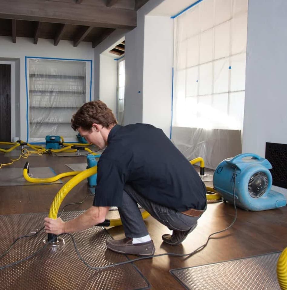
On this shoreline the water that reaches a house often arrives on a day with no rain. Anchor Bay is wide, shallow and wind-driven, and that changes the category, the order of work and the clock. On site in 60 minutes. The estimate is free.
This page is published by Prime Restoration, a Michigan licensed residential builder dispatching to New Baltimore from Sterling Heights. It covers what actually fails on this shoreline rather than what fails generally, and it names a company inside the city that publishes a faster response than we do. Every water level, population number and dated event below is sourced at the bottom of the page. Last updated 2026-09-07.
The thing nobody writes down
Because here the driver is the wind, and a federal publication says so by name.
The NOAA Coast Pilot, the government sailing directions for these waters, describes the mechanism directly. Water levels on Lake St. Clair are pushed around by storms. Strong winds of sustained speed and direction drive surface water forward and raise the level on the shore they are blowing toward. And the effect is largest where water is concentrated in a small space by converging shores, especially where that is coupled with a gradually sloping bottom. The publication names one such place on this lake, and it is Anchor Bay.
The shape of the bay explains why. Anchor Bay covers more than 90 square miles at depths of 1 to 11 feet. That is extraordinarily shallow for a body of water that size. It takes inflow from the St. Clair River, the Clinton River, Black Creek and the Salt River, and it narrows toward the north, which is where the city sits. A long wind down the length of a basin shaped like that does not just make waves. It relocates water.
Three things follow, and they are the reason this page exists.
The forecast you should be watching is the wind, not the rain. A sustained blow from the right direction over twelve hours matters more here than a rainfall total, and it is usually visible a day out. That is enough time to move contents up, get vehicles clear and kill power to the lowest level.
Water arriving from outside is contaminated from the first minute. It crossed ground, lawns and roads to get in. Whatever it looks like, the scope starts with containment and removal, not with drying. A crew treating it as a clean-water loss because it is clear is making an error that shows up three weeks later.
The clock starts when the wind turns. Setting drying equipment into a space that is still taking water is a billed day that achieved nothing. Any contractor who mobilises into an active event without telling you that is charging you for the wrong thing at the wrong time.
None of that applies to a burst supply line in a subdivision three miles inland, which is the other half of this city and a completely ordinary job. Knowing which one you have is the whole first conversation.
The second thing nobody writes down
These are four published numbers. They are individually easy to find and, as far as we can tell, nobody selling restoration on this shoreline has put them in one table.
| What | Feet | Metres | What it means |
|---|---|---|---|
| Low Water Datum, Lake St. Clair | 572.3 ft | 174.4 m, IGLD 1985 | The reference plane charts are drawn to. It is not the bottom and it is not the average. It is the line everything else is measured from. |
| Long-term annual average level | about 574.3 ft | 175.05 m | The published long-term annual mean in the coordinated record. Roughly two feet above the datum. |
| July 2019 monthly mean | about 577.6 ft | 176.04 m | A record. The published figure of 577.56 feet above datum broke 577.20 set in 1986, in a coordinated record that starts in 1918. |
| Published elevation, City of New Baltimore | 584 ft | 178 m | One nominal point for the whole city, not your lot. Read it as a ceiling on how much room the city has, not as a reading on your own doorstep. |
Read down that column. In July 2019 the lake sat roughly five feet above its own Low Water Datum and about three feet above its long-term average, and it stayed at effectively that height through the following summer as well. Two consecutive years at the top of a record that begins in 1918.
Now the honest caveat, stated before anybody can accuse us of overselling it. The 584 foot figure is a single nominal elevation published for the municipality. It is not a reading on your doorstep and it is not a survey of your lot. Shoreline and canal properties sit well below it and inland subdivision properties sit above it. If you want a number you can actually use, that is a surveyor and an elevation figure for your own address, and it is worth doing once.
What the table does establish is the shape of the risk. 31.6 percent of this city’s area is water rather than land, the lake moves several feet between a low year and a record one, and wind moves it further on top of that. A property that never took water can take it twice in three years without a single thing about the property having changed. That is not bad luck and it is not a defect. It is two variables landing at the same time.
The third thing nobody writes down
New Baltimore incorporated as a city in 1931 with 1,148 people. Sixty years later it still had fewer than six thousand. Then it doubled in twenty years and stopped. That produces two housing stocks with a fifty-year gap between them and almost nothing at scale in the middle.
| Census | Population | What was being built |
|---|---|---|
| 1930 | 1,148 | The year of incorporation as a city. A shoreline village on the Salt River with docks, a mill history and summer traffic. |
| 1950 | 2,043 | Still a village in everything but name. Cottage and cottage-converted stock along the water. |
| 1970 | 4,132 | Slow growth. The shoreline fills in ahead of the interior. |
| 1990 | 5,798 | Still under six thousand people. Sixty years after incorporation the city has not quintupled. |
| 2000 | 7,405 | The build-out starts. Poured basements, interior drain tile, sumps, subdivisions inland from the water. |
| 2010 | 12,084 | The population more than doubles in twenty years. Engineered floor systems become standard. |
| 2020 | 12,117 | Flat. The city that exists now was largely built in one fifteen-year window plus one pre-war village. |
The older half is the shoreline village on the original plat, plus the near-water neighbourhoods and the canal frontage. It means crawl spaces and shallow foundations, narrow lots, and materials that are not catalogue items. It also means the water arrives from outside more often than from inside.
The newer half is the 1995 to 2010 build-out inland. It means poured concrete walls, a cove joint, interior drain tile, a sump pit, engineered floor systems and a finished lower level. That half of New Baltimore fails the way the rest of Macomb County fails, which is usually a pump that stopped or a supply line that let go, and it recovers the same way: clean or grey water, a wide save window, and a rebuild that is scheduling rather than sourcing.
A contractor who prices your house from the city name rather than from which half of it you are in is going to be wrong in one direction or the other. Ask which half they think you are in and why.
Why the lots are shaped like that
French hunters and fur trappers were the first inhabitants of this part of Macomb County from around 1796. They took residence along the waterfront and the rivers, and the farms that followed had narrow frontage of roughly 400 to 900 feet running a long way inland from the water.
The modern city was laid on top of that grain rather than replacing it. Alfred Ashley, a Mount Clemens businessman, platted 60 acres on both sides of Washington Street in the middle of the nineteenth century and built the first sawmill and the first dock. The village carried his name until it became New Baltimore in 1867, and the city incorporated in 1931.
That is not local colour. It is a working constraint on a restoration job. Long narrow lots oriented to the water mean the house often sits close to the shoreline with the depth behind it, there is frequently no side yard wide enough to re-establish fall away from the wall on all four sides, and there is nowhere to run hose or stage equipment from. The canal subdivisions dredged later inherited the same perpendicular arrangement, and with it the same access problem.
Portable extraction instead of a truck mount is slower per gallon. That is a real cost driver on this side of town and it has nothing to do with how much water arrived.
Where you are decides what the job is
The city covers about 6.73 square miles, of which about 4.60 are land and about 2.12, or 31.6 percent, are water. Broadly, the further you are from the bay the more ordinary the job becomes. The single most useful thing you can tell somebody on the phone is not your street name. It is whether the water came from inside your house or from outside it.
| Area | Where | Housing or building stock | What tends to fail | What that means for scope |
|---|---|---|---|---|
| The Washington Street plat | The original 60 acres on both sides of Washington Street, downtown | The oldest stock in the city, on the 1851 plat. Narrow lots, older foundations, mixed commercial and residential. | Older assemblies, shallow foundations, and street-level water when the bay is up and the wind is on. | Assume the water is contaminated when it arrived from outside. Assume the material is older than anything a supply-house catalogue covers. |
| The Salt River mouth | Where the Salt River discharges into the north side of Anchor Bay | Marina and small-craft frontage with housing behind it. A slow-no-wake zone is enforced on the river. | River stage and bay level acting together. When the bay is high the river cannot fall, so the two mechanisms stack. | The source is outside the building and it does not stop because the extraction started. Timing the work to the water is half the job. |
| Frog Creek and the small-craft channels | East of the creek, in the dredged channels at New Baltimore | Canal-front housing on privately dredged waterways developed for housing and small craft. | The canal is the water table. A seawall or a bulkhead is the only thing between the finished floor and the bay. | The hardest access and the shortest margin in the city. When a seawall section fails the problem is structural before it is a drying problem. |
| Walter and Mary Burke Park frontage | The public waterfront, beach, fishing and boat docks | Public land rather than housing, but it is the visible gauge. What the park is doing is what your street is about to do. | Nothing that affects a homeowner directly. It is the reference point. | Useful because it tells you the bay level with your own eyes before anybody quotes you anything. |
| Green Street | The older residential grid near the downtown core | Pre-war and post-war village housing. | Crawl spaces and shallow basements, plus roof and gutter assemblies old enough to have been rebuilt more than once. | A crawl space that has been wet is a different job from a basement that has been wet. Less water, more consequence, harder to reach. |
| Anchor Bay Gardens and Anchor Bay Shores | Established near-shore neighbourhoods | A mix of original near-water stock and later infill on the same lots. | Groundwater and bay level rather than plumbing, and a mixed vintage of below-grade construction on one street. | Two houses side by side can need two different plans. Do not let anybody price your street rather than your house. |
| Bay Pointe | Waterfront-oriented development | Newer waterfront and near-waterfront housing. | Newer assemblies with an older problem behind them. The building is modern; the water table is not. | Engineered floor systems dry slower than they look like they should. Shoreline groundwater lengthens it further. |
| The Main Street and M-29 corridor | M-29 through the city as Main Street, running east toward Algonac | Commercial frontage along the shoreline highway. | Flat roofs, storefront thresholds at grade, and surface water off the corridor. | Water travels laterally across a floor plate rather than down through joists, so the affected area is wider and shallower than it looks. |
| The 23 Mile Road corridor | The main east to west arterial inland from the water | Commercial and mixed, with subdivision access off it. | Surface drainage and commercial mechanical failures rather than lake level. | This is the part of the city where the job looks like a normal Macomb County job. |
| The I-94 corridor at Exit 243 | The freeway interchange at Washington Street | Commercial and newer residential behind it. | Mostly ordinary supply-side and mechanical losses. | Standard scoping. The lake is far enough away here that it stops being the first question. |
| The Willow Creek area | Toward County Line Road at the northern edge | Later subdivision housing near wetland and open ground. | Overland flow off adjacent open ground, and moisture and clay in the ground under the slabs and crawl spaces. | A site-water and grading conversation as much as a restoration one. Residents there have publicly described water running through crawl spaces and down the road. |
| The County Line edge | The Macomb and St. Clair County boundary at the north of the city | Newer subdivision stock against township land. | Drainage that crosses a jurisdiction, which is slower to get fixed than drainage that does not. | Worth knowing which county your drain is in before you start making calls about it. |
| The 1995 to 2010 inland subdivisions | Generally west and north of the old village, away from the water | The bulk of the modern city. Poured concrete walls, interior drain tile, sump pits, engineered joists, finished lower levels. | A sump system that stopped, or a supply line. This half of the city fails the way Macomb County generally fails. | Highly recoverable, mostly clean or grey water, and a rebuild that is catalogue work rather than replication. |
Mechanism
The first five are shoreline mechanisms and they barely exist three miles inland. The last three are the ordinary ones. They are distinguishable in the first twenty minutes by where the water is and when it appeared, and the category and the scope both fall out of getting that right rather than assuming it.
| Mechanism | What it actually is | How you tell | What it means for scope |
|---|---|---|---|
| Wind setup on a shallow bay | A sustained wind pushes surface water down the length of the bay and piles it against the downwind shore. On a bay this shallow and this wide, a long blow moves a great deal of water. | The water arrives from outside, at grade, and often on a day with no rain at all. It is at its worst while the wind is still blowing and it recedes when the wind turns. | Contaminated from the first minute because it crossed ground and roads to get in. No sump addresses it. The mitigation clock effectively starts when the wind stops, and that has to be planned for rather than discovered. |
| A high long-term lake level underneath it | Lake St. Clair rises and falls between years as well as within them, and a wind event on a high-level year reaches places a wind event on a low-level year does not. | Neighbours who have lived there thirty years saying it has only happened a few times. That is the two mechanisms coinciding rather than either one alone. | The reason a property that never flooded can flood twice in three years without anything about the property changing. |
| A seawall or bulkhead section failing | The retaining structure between the water and the lot gives way, usually at a joint, usually under wave loading rather than static pressure. | Water arriving at one point rather than along a front, and often visible undermining behind the wall. | Structural before it is restorative. Drying a house behind a failed wall without addressing the wall is buying the same job again. |
| The Salt River unable to fall | A river discharging into a bay that is already high has nowhere to put its water, so river stage rises behind the bay. | Water backing up rather than running out, on the river side rather than the lake side. | Two sources acting together, which is why timing matters. The river will not drop until the bay does. |
| Overland flow off adjacent open ground | Rain running across open, wetland or newly graded ground and arriving at a house from outside the envelope. | Sediment in the water and a path you can see across the yard. | Contaminated by default. Usually a grading and site-drainage fix rather than a drying fix, and we would rather say so. |
| A sump system that stopped | In the 1995 to 2010 subdivisions inland, the primary pump failed, the float hung up, the discharge froze, or the power went out during the storm that needed it. | Water rises evenly from the lowest point of the floor. The pit is full and still. | The most recoverable loss on this list. Usually clean or grey, wide save window, more of the room stays than a homeowner expects. |
| A supply line, water heater or appliance | A braided hose, a tank, a fridge line, a dishwasher, a washing machine. Clean water under pressure with nothing to stop it. | The water is clean and it traces back to a fixture rather than to a wall, a drain or the outside. | The best case in any city. Speed buys back the most material here. |
| Ice, in the shallows | Ice forms early in the shallows of Anchor Bay. Ice loading works on seawalls, docks and shoreline structures over a winter rather than in an event. | Damage found in spring that nobody can date, usually at the waterline. | A shoreline structure conversation. It matters here because it is the thing that quietly weakens the wall that then fails in an autumn blow. |
Dated, with sources
Four entries. Where an entry is a resident account rather than an agency measurement, it says so.
July 2019
Lake St. Clair set a record monthly mean water level. The published figure is 577.56 feet above datum, against the previous record of 577.20 feet set in 1986, in a coordinated record that begins in 1918. The coordinated network figure for the same month is 176.04 metres on the 1985 International Great Lakes Datum. Superior, St. Clair, Erie and Ontario all exceeded their monthly averages for July that year.
June to August 2020
Levels stayed at effectively the same height through a second summer. The coordinated network records 176.02 metres in June 2020, 176.03 in July and 175.97 in August, against 175.99, 176.04 and 175.96 for the same three months in 2019. Two consecutive summers at the top of a hundred-year record is the context for every shoreline loss in that period.
1996
Residents on the north side of the city have publicly described a developer clear-cutting wetlands and the neighbouring area flooding as a result, with water running through crawl spaces and down the road. This entry is a resident account reported in the press rather than an agency measurement, and it is labelled that way here on purpose.
The standing wind record
Peak gusts at Selfridge Air National Guard Base, on the same shoreline south of the city, have been clocked in the 60-knot range, and a line of thunderstorms once produced a 61-knot one-minute wind speed recorded by a ship on Lake St. Clair. That is the upper end of what the bay gets pushed with, and it is why a long moderate blow matters as much as a short violent one.
What moves the number
The estimate is free, and the number for your job comes from readings rather than from a phone call. What is publishable is the list of things that actually move it, in rough order of how much they move it on this shoreline.
Whether the water came from outside the building
The largest lever here and it is not the largest lever in most cities. Water that crossed ground, a road or a lawn to get in is contaminated from the first minute, which means containment, removal of porous material rather than drying it, and cleaning before any drying begins.
Whether the source has actually stopped
On a wind event it has not stopped until the wind turns. Setting equipment into a space that is still taking water is wasted mobilisation, and any contractor who does it without telling you why is billing for a day that did not do anything.
Crawl space or basement
A crawl space holds less water and costs more to resolve per square foot. Access is on hands and knees, the vapour barrier and the insulation almost always come out, and the framing above is what you are actually protecting.
Which half of the city you are in
The 1995 to 2010 inland subdivisions fail like ordinary Macomb County houses and recover like them. The old shoreline village and the canal frontage do not. The same square footage is not the same job across those two.
Whether a shoreline structure is involved
A failed seawall or bulkhead is a structural repair by a different trade, and it has to be sequenced before anything below grade is put back. That is a schedule item, not a line item.
Engineered floor systems
In the newer subdivisions and the newer waterfront stock, an engineered joist holds moisture inside the webbing long after the subfloor surface reads dry. It is the most common reason a drying job runs longer than the room looks like it should.
Access on the canals and the old plat
Narrow lots and canal frontage mean portable extraction rather than a truck mount, which is slower per gallon and changes the staging and therefore the days.
Sequence
Drying ends on a reading rather than on a date, so nothing below is a promise about hours after the first row. It is the order the steps have to happen in.
Hour 0
Establish whether the source has stopped
On a plumbing loss that means a shut-off valve. On a wind or bay-level event it means checking the forecast, because nothing useful happens while water is still arriving. Photograph everything, timestamped, either way.
Hour 0
Do not stand in it if power is on down there
Water arriving at grade reaches outlets and equipment. Kill the circuits from upstairs or have somebody else do it. Nothing below is worth an electrical injury.
Day 0
Category call, then a moisture map
Where the water came from decides the category before anybody looks at a finish. Readings are taken against a dry standard from an unaffected part of your own house. On site in 60 minutes, the estimate is free, and the scope is written down.
Days 1 to 2
Removal and cleaning on a contaminated source
Containment first. Porous material in the affected area comes out rather than being dried. Non-porous and semi-porous surfaces are cleaned and treated. Drying only begins after removal, and that order is not negotiable.
Days 2 to 6
Structural drying, logged daily
Crawl spaces run longer than basements of the same area because air movement in them is harder to control. Engineered joists run longer than solid ones. It ends on a reading, not on a date.
Before the rebuild
Deal with the shoreline or the grading if that was the source
Seawall, bulkhead, grading, downspouts, window wells. Rebuilding over an unresolved shoreline problem is the most expensive mistake available in this city.
Then
Rebuild
In the inland subdivisions this is catalogue work and it is quick. On the old plat and the canals it takes longer, because what came out is not always something you can order.
Stopping the second one
Each measure is listed with what it does not cover, because the failure mode is a homeowner who installed one of these and assumed the problem was solved from every direction. On this shoreline the ranking is unusual: the seawall and the wind forecast beat the sump pump, and on the inland half of the city that ordering flips completely.
Knowing your own elevation, not the city one
What it does: The published city elevation is a single nominal point. Your lot, your threshold and your finished floor are what matter, and a survey or an elevation certificate gives you an actual number to compare against a lake level you can look up any day of the week.
What it does not do: Change anything by itself. It converts an anxiety into a number, which is the first step to spending money sensibly rather than defensively.
Who does it: A surveyor. Worth doing once and keeping.
Maintaining the seawall or bulkhead before it fails
What it does: The retaining structure is the whole margin on a canal or shoreline lot. Joints, undermining behind the wall and ice damage at the waterline are all findable before an autumn blow finds them for you.
What it does not do: Do anything about groundwater arriving under it, or about water coming overland from the street side.
Who does it: A marine or shoreline contractor, and it is a permitted trade near the water. Inspect in spring after the ice goes.
Watching the wind rather than the rain forecast
What it does: The mechanism that floods this shoreline is a sustained wind on a high lake, not a rainfall total. A long blow down the length of the bay is the warning, and it is usually visible a day out.
What it does not do: Prevent anything. It buys time to move contents up, get vehicles out and shut power to the lowest level, which is most of what can be done in the last twelve hours.
Who does it: You. The marine forecast for Lake St. Clair is public and it is more useful here than a rain percentage.
A second sump pump, or a battery or water-powered backup
What it does: In the inland subdivisions this is the highest-value hardware there is, because the dominant loss on that half of the city is a pump that stopped.
What it does not do: Anything at all about water arriving over the ground from the bay. On a shoreline lot it is not the first thing to buy.
Who does it: A plumber for the install, you for the test. Pour a bucket into the pit twice a year with the breaker off and watch the full cycle including the backup.
Sealing the crawl space properly rather than partially
What it does: A crawl space with a continuous, sealed and mechanically fastened liner and controlled humidity is a different building from one with a sheet of plastic laid loose on the dirt.
What it does not do: Keep out water that arrives above the footing during a bay event. It manages ground moisture, which is the everyday problem, not the emergency one.
Who does it: A contractor who will show you the detailing at the wall and the piers, because that detailing is where the cheap version fails.
Grading, downspouts and window wells
What it does: The cheapest measure on this page and the most under-used. On the inland half of the city it removes a large share of the water that would otherwise sit against the wall.
What it does not do: Anything for lake level, wind setup or a canal. It is a rainfall measure.
Who does it: Homeowner or landscaper. On the old plat the lot may be too narrow to grade away on all four sides, and that is worth knowing before paying for it.
The space most often scoped from the doorway
A large share of the older housing on this shoreline sits over a crawl space rather than a basement. A crawl space holds far less water than a basement of the same footprint and it routinely costs more per square foot to resolve, which surprises people every time.
Four reasons, and none of them are negotiable:
If somebody quotes your crawl space without going into it, that is not a quote. Ask how air will be moved down there and how readings will be taken, and expect a specific answer.
Mold, handled the boring way
Almost every mold call on this shoreline is the second half of a water story, and a good share of them are in a crawl space. Something was wet, it stayed wet, growth followed. So the work starts with the source rather than with the surface, because treating a surface over a live source is a repeat visit with a receipt attached.
The first job is establishing which source it is: groundwater from a high water table, a plumbing leak from above, ventilation and condensation, or water that arrived during an event. Those four have four different fixes and only one of them is a restoration job. From there the sequence is ordinary. Contain the affected area so nothing travels. Remove porous material that cannot be cleaned, which in a crawl space usually means the barrier and any insulation. Clean what can be cleaned. Dry the assembly to a documented standard so the conditions that produced the growth are gone.
Two things we will not do, and both of them cost us money. We will not tell you what species anything is, because that takes a laboratory and it does not change what gets removed. And we will not clear our own work. Testing and post-remediation verification should come from an independent hygienist with no financial interest in the outcome. A contractor who remediates and then certifies their own remediation is marking their own exam, and you should treat the offer as information about the contractor.
Anything to do with health belongs to a physician or a public health authority. It is not something a restoration contractor should be telling you, and we will not.
Before anyone starts
These work on our estimate as well as anyone else’s, which is the point of publishing them. The first two are the shoreline-specific ones and they are the two that save money.
“Where did this water come from, and what category are you calling it?”
In this city that question has two very different answers on two sides of town. Water that came in from outside is contaminated regardless of how clean it looks, and the scope changes before anybody measures a wall.
“Has the source stopped, and how do you know?”
On a wind event it has not stopped until the wind turns. Setting equipment into a space still taking water is a billed day that achieved nothing.
“What is your dry standard, and where did you take it?”
It should come from an unaffected part of your house. A target from a manual is not a target for your building.
“Is my crawl space in this scope, and how are you drying it?”
Crawl spaces get scoped from the doorway and dried badly more often than any other space. Ask how air is being moved and how the readings are being taken down there.
“Is a shoreline structure involved, and who is handling that?”
If a seawall or a bulkhead failed, that is a different trade and it has to be sequenced first. You want that said before equipment is set, not after the rebuild.
“What are you removing, and can you show me the reading that says so?”
Removal should be justified surface by surface. On a clean-water loss inland, the correct answer is usually less removal than a homeowner expects.
“If mold is involved, who does the testing and who does the clearance?”
The right answer is an independent hygienist and not the company doing the removal. Anybody who offers to both remediate and clear their own work is marking their own exam.
“Will I see the daily log?”
Structural drying ends on a reading. If nobody is writing readings down daily, nothing is ending on one.
The honest part
Anytime Restoration Services operates from 35147 23 Mile Road in New Baltimore and publishes a 30 minute response time on its own site. That is half of what we publish, from an address inside the city. We are not going to pretend otherwise on a page asking you to trust us.
SERVPRO of Mount Clemens, New Baltimore operates from 42259 Irwin Drive in Harrison Township and names New Baltimore in its service area. Also closer than Sterling Heights.
So if water is arriving right now, call whoever can stop it soonest. That is the same advice we would give a relative, and on a plumbing loss it is worth more than any argument on this page.
There is one case where speed is not the deciding factor, and it is the case this shoreline specialises in. On a wind or bay-level event, nobody useful is setting equipment while water is still arriving. What matters then is who reads the situation correctly, calls the category honestly, sequences the shoreline structure before the finishes, and holds the mitigation and the rebuild together afterwards so nobody hands your job across a seam. We are a licensed residential builder as well as a restoration contractor, which is the part of that we can actually claim.
Because on this shoreline the driver is wind rather than rainfall. The NOAA Coast Pilot describes the mechanism directly: strong winds of sustained speed and direction drive surface water forward and raise the level on the shore they are blowing toward, and the effect is greatest where water is concentrated in a small space by converging shores coupled with a gradually sloping bottom. It names Anchor Bay as such a place. Anchor Bay covers more than 90 square miles at depths of only 1 to 11 feet, which is extraordinarily shallow for that area, and it takes the inflow of the St. Clair River, the Clinton River, Black Creek and the Salt River. A long blow down the length of a bay shaped like that moves an enormous volume of water toward the northern shore, which is where the city is. So the useful forecast here is not a rain percentage. It is wind direction and duration, and a long moderate blow can matter more than a short violent storm.
High enough that the numbers are worth putting side by side, because nobody in this market does. The Low Water Datum for Lake St. Clair, the reference plane charts are drawn to, is 572.3 feet, or 174.4 metres on the 1985 International Great Lakes Datum. The published long-term annual average is about 175.05 metres, roughly two feet above that. In July 2019 the monthly mean was 176.04 metres, published as 577.56 feet above datum, which broke the previous record of 577.20 feet set in 1986 in a coordinated record that begins in 1918. Levels stayed at effectively that height through the summer of 2020. Set against that, the published elevation figure for the City of New Baltimore is 584 feet, and 31.6 percent of the city area is water rather than land. That elevation figure is one nominal point for the whole municipality and it is not a reading on your doorstep, but the gap it describes is the reason a wind event on a high-level year reaches places a wind event on a low-level year does not.
Completely differently, and the difference is decided in the first ten minutes rather than at the end. Water that arrived from outside the building crossed ground, lawns and roads to get in, so it is treated as contaminated from the first minute regardless of how clear it looks. That changes the whole order of work. Containment goes up before anything is moved. Porous material in the affected area is removed rather than dried, which usually means carpet, pad, insulation and the lower band of wall. Non-porous and semi-porous surfaces are cleaned and treated. Only then does drying begin. A burst supply line is the opposite case: clean water, no contamination question, the widest save window there is, and a scope where the goal is to open as little as possible. Two losses of identical size and identical square footage can therefore be an order of magnitude apart, and the variable is where the water came from rather than how much of it there was.
The canal is your water table, and a seawall or bulkhead is the only thing between it and your finished floor. Three consequences follow. First, groundwater is a standing condition rather than an event, so a crawl space or a lower level is fighting moisture on ordinary days as well as on bad ones. Second, when a retaining structure fails it is a structural problem before it is a restoration problem, and drying the house without addressing the wall means buying the same job again. Third, access is genuinely difficult. Narrow canal lots often have nowhere to run hose or stage equipment, which means portable extraction rather than a truck mount, which is slower per gallon and adds days. The other thing worth knowing is that ice forms early in the shallows of Anchor Bay and works on shoreline structures all winter. A wall that fails in an autumn blow was often weakened the previous February.
Because this is two cities with a fifty-year gap between them, and the census shows it plainly. New Baltimore incorporated as a city in 1931 with 1,148 people. Sixty years later, in 1990, it still had only 5,798. Then it went to 7,405 by 2000 and 12,084 by 2010, and it has been effectively flat since. So the housing is either pre-war village stock on the old shoreline plat, or it is a 1995 to 2010 subdivision build-out inland, with very little at scale in between. The old stock means crawl spaces, shallow foundations, narrow lots and materials that are not catalogue items. The new stock means poured concrete walls, interior drain tile, a sump pit, engineered floor systems and a finished lower level. The inland half of the city fails the way the rest of Macomb County fails, which is usually a pump or a supply line, and it recovers the same way. The shoreline half does not.
Because it was platted by French farmers before it was platted by anybody else. French hunters and fur trappers were the first inhabitants of this part of Macomb County from about 1796, and the settlers took residence along the waterfront and the rivers, developing farms with narrow frontage of roughly 400 to 900 feet running a long way inland from the water. The modern city started on top of that grain. A Mount Clemens businessman named Alfred Ashley platted 60 acres on both sides of Washington Street in 1845 to 1851 and built the first sawmill and the first dock, the village was called Ashley until the name changed to New Baltimore in 1867, and the city incorporated in 1931. That history is not decorative. It is why the old shoreline lots are long, narrow and oriented to the water, why there is often no side yard to grade away on, and why the canal subdivisions that came later inherited the same perpendicular-to-the-water arrangement.
Growth in a crawl space near this shoreline is a moisture problem before it is anything else, so the work starts with the source rather than with the surface. That means establishing whether the moisture is groundwater, a plumbing leak above, ventilation and condensation, or water that arrived during an event, because the four have different fixes. From there the sequence is containment, removal of porous material that cannot be cleaned, which in a crawl space usually means the vapour barrier and any insulation, cleaning of what can be cleaned, and drying the assembly to a documented standard. Two things we will not do. We will not tell you what species anything is, because that takes a laboratory and it does not change what gets removed. And we will not clear our own work: testing and post-remediation verification should come from an independent hygienist with no financial interest in the result. Anything to do with health belongs to a physician or a public health authority, not to a restoration contractor.
There is, and it would be strange not to say so. Anytime Restoration Services operates from 35147 23 Mile Road in New Baltimore itself and publishes a 30 minute response time, which is faster than the 60 minutes we publish. SERVPRO of Mount Clemens, New Baltimore operates from 42259 Irwin Drive in Harrison Township and names New Baltimore in its service area. Both of those are closer than we are, and if water is arriving right now the correct advice is to call whoever can stop it soonest. That is what we would tell a relative. Where we would argue for ourselves is what happens after the water stops. We are a licensed residential builder as well as a restoration contractor, so one accountable crew holds the mitigation and the rebuild together and nobody hands your job across a seam. On a shoreline loss that seam is where the crawl space, the shoreline structure and the finished space above it either get sequenced properly or get done in the wrong order.
Sources
The Low Water Datum of 572.3 feet and 174.4 metres on the 1985 International Great Lakes Datum, the description of how sustained wind raises the water level on the downwind shore, the note that the effect is greatest where converging shores and a gradually sloping bottom concentrate the water, the naming of Anchor Bay in that passage, the observation that ice forms early in the shallows of Anchor Bay, the Selfridge peak gust figures, the position of New Baltimore at the mouth of the Salt River, and the slow-no-wake enforcement in Frog Creek and the small-craft channels all come from the NOAA Coast Pilot chapter covering Lake St. Clair.
The Anchor Bay surface area of more than 90 square miles, the depth range of 1 to 11 feet and the primary inflows from the St. Clair River, the Clinton River, Black Creek and the Salt River come from the public encyclopaedia entry for Anchor Bay.
The monthly mean water levels in metres for 2019 and 2020, the long-term averages and the start of the record in 1918 come from the Canadian government coordinated network record for Lake St. Clair. The July 2019 record figure of 577.56 feet above datum and the previous record of 577.20 feet set in 1986 were reported from Army Corps of Engineers data in the Detroit News on August 6, 2019, read this run through a search-index summary because the article itself is behind a paywall.
City area, land and water split, elevation, postcode, incorporation dates and the census populations from 1930 to 2020 come from the public encyclopaedia entry for New Baltimore, as does the M-29 and Main Street alignment east toward Algonac.
The French settlement from 1796, the farms with narrow frontage of 400 to 900 feet running inland from the water, Alfred Ashley platting 60 acres on both sides of Washington Street, the first sawmill and dock, the village name of Ashley and the change to New Baltimore in 1867 come from the City of New Baltimore history record and the local historical society.
The 1996 wetlands account and the description of water running through crawl spaces are resident statements reported in a Detroit television news investigation dated May 22, 2023. They are labelled on this page as a resident account rather than an agency measurement, and no damage figure from that report is reproduced here.
Neighbourhood and subdivision names come from published neighbourhood records and are general descriptions of each area rather than claims about any specific address.
Competitor names, street addresses and published response claims were read from those companies’ own pages and are attributed where they appear. No company paid to be referenced on this page.
This page makes no claim about how the city’s sanitary or storm sewers are arranged, because no first-party municipal source for that was found this run. Confirm your own arrangements, and any permit or code requirement, with the City of New Baltimore. Water categories, drying practice and remediation sequence follow restoration industry standard. No customer, address or job is described anywhere on this page.
24/7 dispatch across 48047 and the Anchor Bay shoreline. On site in 60 minutes. The estimate is free, and it comes with moisture readings, a written scope, and an honest answer about whether you need us at all.
Call (586) 277-1069Prime Restoration is a Michigan licensed residential builder (MI Residential Builder #262500492) and a full-service restoration contractor serving New Baltimore and the surrounding area from Sterling Heights. Nothing on this page is legal, plumbing, electrical, marine, engineering or medical advice. Scope and cost are set from actual moisture readings and affected square footage. Water levels, population figures and competitor details are cited above and were current when read; confirm anything load-bearing with the issuing authority or the company named. The published city elevation is a single nominal figure and is not a survey of any individual property.
The housing stock changes faster than the drive time does. Each of these is a different problem rather than the same page with the city name swapped.